
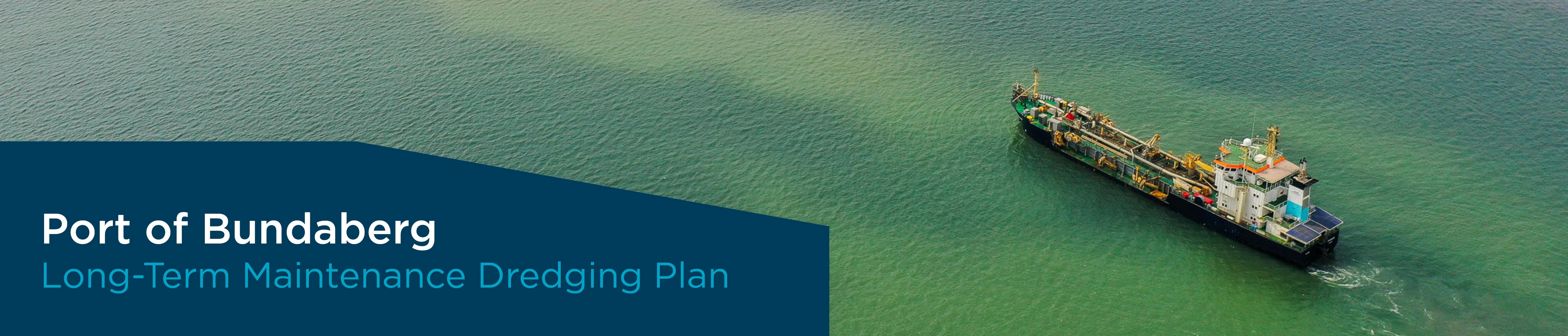
Port of Bundaberg Long-Term Maintenance Dredging Plan
Consultation on the Bundaberg Long-Term Maintenance Dredging Plan has concluded.
As a result of the Reef 2050 Long-Term Sustainability Plan, the Queensland Government launched the Maintenance Dredging Strategy, which requires ports in the Great Barrier Reef World Heritage Area (GBRWHA) to develop a Long-Term Maintenance Dredging Management Plan (LMDMP).
While the Port of Bundaberg does not lie within GBRWHA, for consistency and best practice across our port operations, GPC has elected to transition our current 10-year plan to a LMDMP, in general accordance with the Maintenance Dredging Strategy framework.
The LMDMP will ensure a robust and predictable long-term approach to planning, consultation, monitoring and reporting of maintenance dredging activities by addressing operational needs, environmental risks and adaptive management actions specific to the Port of Bundaberg. The plan will be developed in a transparent manner with the intent of being a tool for continuous improvement.
You have been identified as a key stakeholder in this process and we are seeking your input and feedback on the proposed plan.
Review the plan now and submit your feedback to have your say on long-term maintenance dredging in the Port of Bundaberg.
Submissions
Consultation on the Bundaberg Long-Term Maintenance Dredging Plan has concluded.
CLOSED: Consultation on the Bundaberg Long-Term Maintenance Dredging Plan has concluded.

Who's Listening
-

Phone (07) 4976 1232 Email TobinT@gpcl.com.au
The Department of State Development, Infrastructure, Local Government and Planning (DSDILGP) thanks you for providing the opportunity to comment on the Draft Port of Bundaberg Long-Term Maintenance Dredging Management Plan.
DSDILGPs support of this discussion paper is dependent on the following changes being actioned:
Page 21, Section 2.3 Current and Future Use:
• Paragraph four references an oil storage facility adjacent to the John T. Fisher Wharf (bulk liquids wharf). It is State Development Group’s understanding these facilities were removed and site remediated in early 2021. Confirmation of the status of these facilities should be confirmed with the Port of Bundaberg Manager.
• DSDILGP recommends the following sentence in paragraph six include a reference to break bulk.
“GPC continues to explore other opportunities for future trade and expects to see an increase in dry bulk and break bulk throughput with key asset development.”
• DSDILGP recommends consideration be given to this section acknowledging the opportunity and suitability of the Port of Bundaberg for transshipping activities.
River ports such as Port of Bundaberg (PoB) are generally subject to vessel size restrictions and the influence of sedimentation due to flooding events. The growth and development of the PoB is challenged by ship size constraints at its existing river berths, limited to vessels of up to 200 metres length overall, with a beam up to 33 metres and approximately 30,000 tonne at present.
Transshipping is recognised by industry, regional stakeholders and the Gladstone Ports Corporation as an opportunity to address this challenge and support growth and investment at the PoB and Bundaberg SDA. Opportunities exist for transshipping to support new trade through the PoB in the export of minerals such as bauxite and imports of oversize over mass break bulk i.e. wind farm components.
The PoB is located adjacent to the Bundaberg State Development Area, just south and outside of the Great Barrier Reef Marine Park and Great Barrier Reef World Heritage Area. The Environmental Protection (Transshipping Activities) Amendment Regulation 2020 uniquely positions PoB for transhipping activity.
Sea Turtle Alliance Inc. (STA) response to GPC Draft Bundaberg Port Dredging Management Plan 15/11/2021
Thank you for this opportunity to comment on your draft Long Term Maintenance Dredging Plan for the Port of Bundaberg.
Reading through this document we are pleased to note the number of safeguards built into this draft plan which are designed to eliminate what could be potentially very damaging environmental consequences from sea floor dredging. We respectfully hope that all the stated measures in the plan are strictly enforced to ensure the rich biodiversity of the Bundaberg Port is maintained.
Your plan in accordance with the Reef 2050 states the following:
1. Identifies each port’s historical dredging volumes and likely future requirements and limits
2. Identifies appropriate environmental windows to avoid coral spawning, seagrass recruitment, turtle breeding and weather events
3. Examines opportunities for the beneficial reuse of dredge material or on-land disposal from maintenance activities
4. Establishes requirements for risk-based monitoring programs.”
In the section on International and Commonwealth Government Agreements your plan also states that it will operate under the auspices of the 1996 Protocol to the Convention on the Prevention of Marine Pollution by Dumping of Wastes and Other Matter 1972 (London Protocol), The Environment Protection (Sea Dumping) Act 1981 (Sea Dumping Act), and The Environment Protection and Biodiversity Conservation Act 1999 (EPBC Act) and additionally the National Assessment Guidelines for Dredging 2009 (NAGD), which hopefully provide sufficient controls to ensure a safe environment for marine creatures and sea birds is maintained.
These agreements are further strengthened by the Queensland Government legislation including the Transport Infrastructure Act 1994 (TI Act), the Sustainable Ports Development Act 2015 (SPD Act), the Coastal Protection and Management Act 1995 (CPM Act) and the Environmental Protection Act 1994 (EP Act).
We also note that there has been established a Technical Advisory Consultative Committee (TACC). This committee’s consultative role is intended to ensure that interested stakeholders have a forum to understand GPC’s maintenance dredging activities and to assist GPC and regulatory agencies to access local knowledge and reconcile various stakeholder interests. The plan also states that the TACC function and effectiveness is enhanced by transparency in their membership, their mandate, their access to information during meetings and upon request, their consensus forming and reporting mechanisms, their minutes or communiques, and by the transparency of GPC’s responses to TACC recommendations. The TACC Terms of Reference (ToR) and minutes of TACC meetings will be available on the GPC’s website and provided to TACC members and meeting attendees.
The draft plan further states that the key environmental assets of the Port include intertidal habitats, benthic macroinvertebrates, fish, shellfish, shorebirds, and marine megafauna, especially marine turtles. The Port is situated across from Barubbra Island Conservation Park, adjacent to Mon Repos Conversation Park with the Port limits excluded from, but surrounded on three (3) sides, by the Great Sandy Marine Park (GSMP). Regarding Sea Turtles, it states that several marine turtle species have been recorded in the area. The Mon Repos Conservation Park is located approximately 4 km south of Burnett Heads. Mon Repos Beach is the most significant endangered loggerhead turtle rookery in the southern hemisphere, with small numbers of flatback and green turtles also nesting there. Your plan should also acknowledge that significant numbers of endangered loggerhead turtles also nest on Barubbra Island and on the many sandy beaches to the north and south of the Port.
During the nesting season (October to February), sea turtles will inhabit the coastal waters off Burnett Heads within the Port limits, and are known to use the dredged channel as inter-nesting habitat. It is possible that green turtles may frequent the vicinity of the Port year-round, foraging on seagrass, macroalgae, mangrove propagules and other food sources.
Green turtles feed on sea grasses so the loss of that habitat would be detrimental to the species. This loss could occur from the direct dredging, increased turbidity or by sediment build up on sea grass meadows.
As stated in point 2 above, it would therefore be very beneficial if all dredging operations were conducted outside the turtle season, which runs from 15 October to 30 April. By not dredging during this time, many of the detrimental dredging issues relating to sea turtles would be successfully overcome.
The draft plan also states that the offshore DMPA and immediate surrounds support extensive seagrass meadows. Your studies have shown that dredge plumes were short-term, infrequent, low intensity features. Despite this it also states that it is possible that a combination of dredging and a sustained period of high turbidity resulting from wind driven events could result in adverse short-term impacts to seagrass meadows within the DMPA. This is of great concern to us and we seek your assurances that this will be closely monitored to ensure that any impacting from dredging on the sea grass meadows is promptly addressed and rectified.
Whilst the dredging plumes on our Turtle nesting beaches are predicted not to extend to turtle nesting beaches, any failures in this regard would pose a threat to both the nesting turtles and their hatchlings. This could be simply eliminated by only dredging outside of the turtle season.
Whilst a dredger is slow-moving, providing marine megafauna including sea turtles, time to evade the approaching vessel there has been at least four instances of turtles being dredged up and killed in the past ten years. In addition to the current nesting species, other species of sea turtle use our coastline as their feeding habitat all year round. We feel, that all dredging operations should therefore be aware of this and also have in place strategies to avoid dredging of all marine animals.
We are pleased to note in the draft plan that sea turtle deflection devices: a flexible chain deflector attached to the drag heads prevent the entrainment of marine turtles during dredging operations. Hopefully this is a worthy addition to all dredges operating in Queensland coastal waters.
On behalf of STA thank you for this opportunity to respond.
Gary Brandon
glbrandon@gmail.com
15/11/2021
Figure 7: Port of Bundaberg Matter of State Environmental Significance Map does not include all MSES likely to be be present in the Port of Bundaberg Area. MSES Marine plants and MSES waterway providing for fish passage are not shown on the mapping layer. A caveat should be included to highlight that this map is not an accurate representation of all MSES within the Port limits.
General: It would be beneficial for GPC to use historical and updated mapping to indicate the presence of marine plants. This information should be used as a starting point for planning, with reference to the potential sediment use options. This would help guide avoidance of known areas hosting MSES marine plants and the potential impacts associated with the proposed option. Any progression of works would require updated surveys prior to development applications.
Table 10: Port of Bundaberg Long-term monitoring schedule : note: timing of seagrass surveys should be undertaken at an appropriate time of year when seagrass is in its maximum growth phase. Any significant natural events that may impact on seagrass (e.g. cyclones) should be noted and monitoring avoided or additional surveys undertaken once communities have recovered to ensure an accurate reflection of seagrass locations and extent.